MPIA Heidelberg
From hms.sternhell.at
Revision as of 13:18, 28 April 2016 by GuentherWuchterl (Talk | contribs)
File:Location:
on top of the roof of the MPIA Heidelberg
geogr. longitude: E 8°43'22"
geogr. latitude: N 49°23'47"
altitude: 560m a.s.l.

Luxmeter on top of the roof of the MPIA Heidelberg.

Overview of northern direction.

Overview of eastern direction.


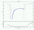
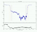
12.10.2008
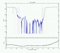
13.10.2008

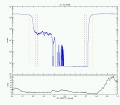
14.10.2008
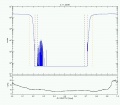
15.10.2008
16.10.2008
17.10.2008

18.10.2008
19.10.2008
20.10.2008
21.10.2008

22.10.2008
23.10.2008
24.10.2008
25.10.2008
26.10.2008
27.10.2008
30.10.2008
31.10.2008

01.11.2008
02.11.2008
03.11.2008


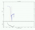
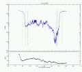
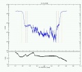
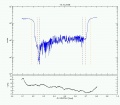
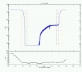
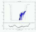
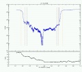
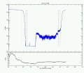
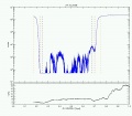
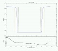
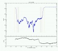
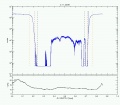
Orange dashed line is indicating rising and setting time of the sun. Red dashed line is indicating Nautical twilight. Black dashed line is indicating Astronomical twilight.